2016 TGO Challenge Day4
Planned: Fort Augustus to Glen Markie ruins (16.75 miles)
Actual: Fort Augustus to Stronelairg Lodge (15.5 miles)
Total Trip Miles: 54.25
Monday, May 16th, 2016
 |
| Day 4 |
After a nice breakfast in the B&B I said my goodbyes to Kenny and Ava, who I made plans to meet up with in Braemar on Friday. This is the only day on my challenge that I walked alone all day. My walk began with ~2mi road walk from town. I had some pretty good views of farmland and Loch Ness for a while.
 |
| Looking back towards Fort Augustus |
 |
| The very southern tip of Loch Ness |
 |
| Ruins on a farm |
I turned off the paved road when I got to Glendoe Estates, which I would be walking through for most of the day. I followed the LRT up into the hills, only seeing a pickup truck that passed me twice.
 |
| Whatever you say, buddy. |
 |
| Wind farm in the distance |
 |
| A lake near the top of one of the hills |
 |
| Snow up around 2,500 ft |
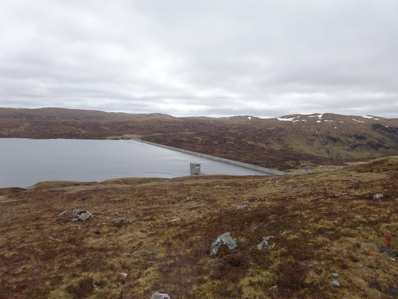
The LRT lead me through the Glendoe Forest, up and up hills that didn't have names on the map. For a while it seemed like the climb up would never end. It was probably about 4 to 4.5 miles but it seemed longer. Eventually I made it to the top, where it was probably near freezing, and then down a bit to the Glendoe Hydro Electric Dam and reservoir.
 |
| The monument for the Hydro Electric Dam |
 |
| Close up |
 |
| The dam |
I walked along the reservoir for a while and had my first blackfly experience. It wasn't bad as it was pretty windy and they seemed to dislike that. When it would be calm they would start to swarm, but they didn't sting me so all was good.
 |
| Finally got a pic of a grouse. It's harder than you'd think. |
After some more walking on the LRT I came to the point where I would be going off-trail across the bog to find a path. I also had to cross a small burn (river) to get to the path. I set a bearing on my compass and set off. I managed to find an easy place to cross the river by hopping over some rocks, but when I got to the spot where the trail should be there was nothing. I bog hopped in the direction I was supposed to be going, all the while looking for this nonexistent trail. I would occasionally find vague trails, but they would soon disappear. I was heading into a valley that the river ran down into, so I just followed the route of the river.
Eventually I found the beginning of the trail I was supposed to be on, only the beginning was a good mile farther east than it showed on the map. The trail took me through the valley, crossing a couple places where there had been rock slides.
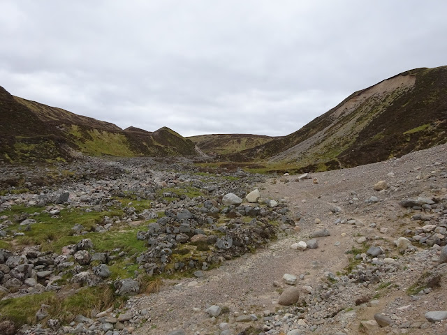 |
| You can see the tiny new trail people have made through the rock slide |
 |
| the trail I followed into the valley |
I passed a guy camped on the other side of the river from me and tried to talk to him, but the rushing water was too loud and I soon gave up. Another mile further up the trail I saw Stronelairg Lodge. I came over the hill above the lodge so I had a good view of the roof, and as I got closer I noticed how spooky the place looked. The bottom floor was all boarded up, the roof was collapsing in places, and it looked like some structure off the back of the lodge had collapsed. I was told that at some point it becomes too expensive to make it worth maintaining these lodges and the owners allow them to fall into ruin.
 |
| Stronelairg Lodge |
The path crossed the front of the lodge's property and I noticed across from the front yard there was a tent pitched. I went over to say hi and met Mervyn, who was from England, and was 67 years old(I think). We did the usual introduction and gear talk. He was an extremely nice guy and seemed to have lots of stories to tell. I decided to set up camp with him as there was a relatively flat field. This meant a longer day the next day, but there was a long-ish uphill before my planned campsite and it was relatively late in the day.


No comments:
Post a Comment