Monday, June 27, 2016

2016 TGO Challenge Day 7

2016 TGO Challenge Day 7

Planned: Glenmore Campsite to Derry Lodge (17.25 miles)
Actual: Aviemore to Derry Lodge (18.5 miles)
Total Trip Miles: 103.75
Thursday, May 20th, 2016
Day 7

My original plan for this day was to summit Ben Macdui, at 4,295 ft it's the second highest summit in Scotland, but I heard there was still lots of snow up there and the weather forecast for the afternoon was not looking good.   My only alternative that didn't add 21 miles to my route was to go through the Lairig Ghru, which is a pass that runs just west of Ben Macdui but still reaches 2,800 ft, so weather would still be a concern.  I woke up early in an attempt to get through the Lairig Ghru before the worst of the weather set in.  I had to do 7 or 8 miles to even get to the pass, so I knew I'd still risk facing some of the nasty weather.

I said goodbye to John and Mervyn, as I didn't expect to see them again until the end.  From Aviemore I began the day with a 1.5 mile walk along a B road that took me to a well-marked approach trail to the Lairig Ghru.  The path went along a campsite and I saw a bunch of other challengers.  Pretty much everyone I talked to said they'd be camping at Derry Lodge tonight, which was also my destination.  The path was peaceful and flat for the next three miles, which allowed me to make good time.

The first real forest I walked through


Black slugs that were all over the place most mornings

The Cairngorm Club Footbridge
 Shortly after the Cairngorm Club Footbridge, I made a southward turn and the trail started to go up, never getting too steep, but a long steady climb that would take me from about 1,100 feet up to 2,800 feet at the highest point of the Lairig Ghru.  As I climbed out of the forest the wind started to really pick up and dropping the temperature.  Just before I entered the pass proper, the rain started to fall.  Once I got into the pass, the steep rock walls created a wind tunnel that funneled the wind and rain straight into my face.  The gusts had to be about 45 mph, and with that wind chill the temperature was probably below freezing.

Some pictures of the approach:


I would be heading right into the pass on the right side of the picture

 Even with my rain gear on I was soaked, but the climb up through the pass wasn't too bad until nearly the top.  Low-lying clouds made visibility near zero, and the trail went over rock fields.  The rock fields were wet,wobbly, and covered in snow which made for slow going.  Two German backpackers passed me, they were on vacation and had hoped to summit Ben Macdui today also.  They were moving quickly and soon I lost sight of them in the cloud cover.  At each rock field I had to guess where the trail really went since the snow obscured the small trail, and then after the field try to find the trail again that led me to the next rock field.  In good visibility this system would have been much easier.

Looking straight up the rock wall of the Lairig Ghru.  Somewhere beyond that would be Ben Macdui, covered in cloud and snow. 

Just near the top of the pass, Matt and Lindley (mentioned on day 5) caught up to me.   I joined up with them as in these conditions I figured being with others was probably safer.  The 4 miles (or so) through the pass was slow going because of the weather; we were all soaked and relieved when we saw Corrour Bothy appear.  We detoured over to the bothy to take a lunch break and warm up.  Inside the bothy felt warm, but we soon realized it really wasn't very warm in there, it was just that we had been doing intense physical activity.  We ate a quick lunch and headed out again (once we got outside and the wind hit us I was shivering).

One of the views coming down from the Lairig Ghru
Another valley to the west of the path
Matt and Lindley crossing a bridge
The next 4 miles was a relatively easy hike on a gradually descending path.  It was a nice change from the intensity of the Lairig Ghru.  We arrived at Derry Lodge about 6pm expecting to see it bustling with people but nobody was there.  We walked another 10th of a mile to the Bob Scott Memorial Hut.  We camped outside the hut but there were 6 people staying in the hut, none of them challengers.

View of the hut and Matt and Lindley's tent
The view from the door of my tent -- not too shabby

Overall it was a fun but exhausting day.  The Lairig Ghru is supposed to be a beautiful hike, but unfortunately I was in a cloud for the high parts.  We did get some spectacular views on our way down from the pass.  I had dinner and was in my sleeping bag pretty early.  Tomorrow was a town day so I wanted to get an early start!

Tuesday, June 21, 2016

2016 TGO Challenge Day 6

2016 TGO Challenge Day 6

Planned: River Dulnain Campsite to Glenmore Campground (14.25 miles)
Actual: Bridge at Coignafeuinternich to Aviemore (16 miles)
Total Trip Miles: 85.25
Wednesday, May 18th, 2016


Day 6

The rain never stopped overnight, and continued into the morning.  Luckily when I got around to packing up my tent the rain had slowed to a drizzle so I was able to get a good amount of water off of it so I didn't have to carry that water weight.  Unfortunately the rain wouldn't let up for the entire day so there aren't many pictures.  

Mervyn and I left our campsite about 8:15.  The day began with a 3 mile walk up the LRT where we gained about 1,000 feet of elevation.  The track we were on would end and then we'd have a nearly 3 mile walk across the bog with no trail of any sort to follow.  We met another Challenger by the name of John Enoch shortly after leaving camp.  John would end up joining us for the entire day into Aviemore.  As the elevation increased the wind picked up and the temperature dropped.  We stopped for a break and realized we were farther north than the map showed the LRT going.

Looking back into the valley on the way up
 The three of us took a bearing and headed off into the bog.  We kept hearing a loud booming sound which we thought was a shotgun.  As we plodded through the bog it began to get foggy and we still occasionally heard the booming noise.  Just great, not only is someone out there with a gun, but it's foggy too.  It was tough going through the bog, jumping from grass tussock to grass tussock to avoid the worst of the wet ground.  It was cold, windy, and rainy too.
 
The crossing began on the bottom left at the double dotted line.  We climbed up and then across and followed the river to the other track on the right side of the map.  The hunting lodge is where the red X is on the right-center.
We eventually found the river we intended to parallel until we hit the road.  It took us a lot longer than anticipated as the terrain really prevented us from making any speed.  (I'm glad Mervyn told me not to attempt this crossing the previous night as I would have been beyond exhausted.)  After following the river for a while we finally made it to the other road we were seeking.  There was a hunting lodge that wasn't on any map.  The hunting lodge was unlocked so we let ourselves in to warm up and have lunch.  We were joined by 5 or six other challengers who showed up.  The lodge was just a one room building with a table and benches in it. 

After a quick lunch (we all started to get cold real quickly) we headed out. We made a quick stop at the Red Bothy to sign the register.  Then it was the long walk down the Burma road.  The first two miles of the nearly straight track was a gradual uphill, with about 500 feet of elevation gain.  The next half mile or so was a much steeper uphill climb back up into the clouds.  Then it was a long downhill to get into Aviemore, the last part of which was on the B road leading into town.

The Burma Road -- Not sure why it's called that

Originally my plan was to go further on to the Glendoe campsite, but I had added miles from the previous two days.  Mervyn's plan was to not even get into Aviemore until the following day, but decided to go the extra distance and have a real short day the next day.  John's plan was to get a hotel room with some other Challengers once we got into town.  Mervyn and I paid for a spot at the campsite right on the edge of Aviemore, and about an hour later John joined us as the hotel was booked.

John and I decided to walk to the fish and chips place down the street but it was closed when we got there.  There was an Indian restaurant open next door so he offered to treat me to dinner there.  So, if you ever read this, thanks again John!!

***It rained into the early afternoon so I had my camera put away.  In the afternoon I am sure I took some pictures but unfortunately they seem to be lost so that is why there is a lack of pictures in this post***


2016 TGO Challenge Day 5


2016 TGO Challenge Day 5

Planned: Glen Markie ruins to River Dulnain Campsite (18.75 miles)
Actual: Stronelairg Lodge to Bridge at Coignafeuinternich (15 miles)
Total Trip Miles: 69.25
Tuesday, May 17th, 2016
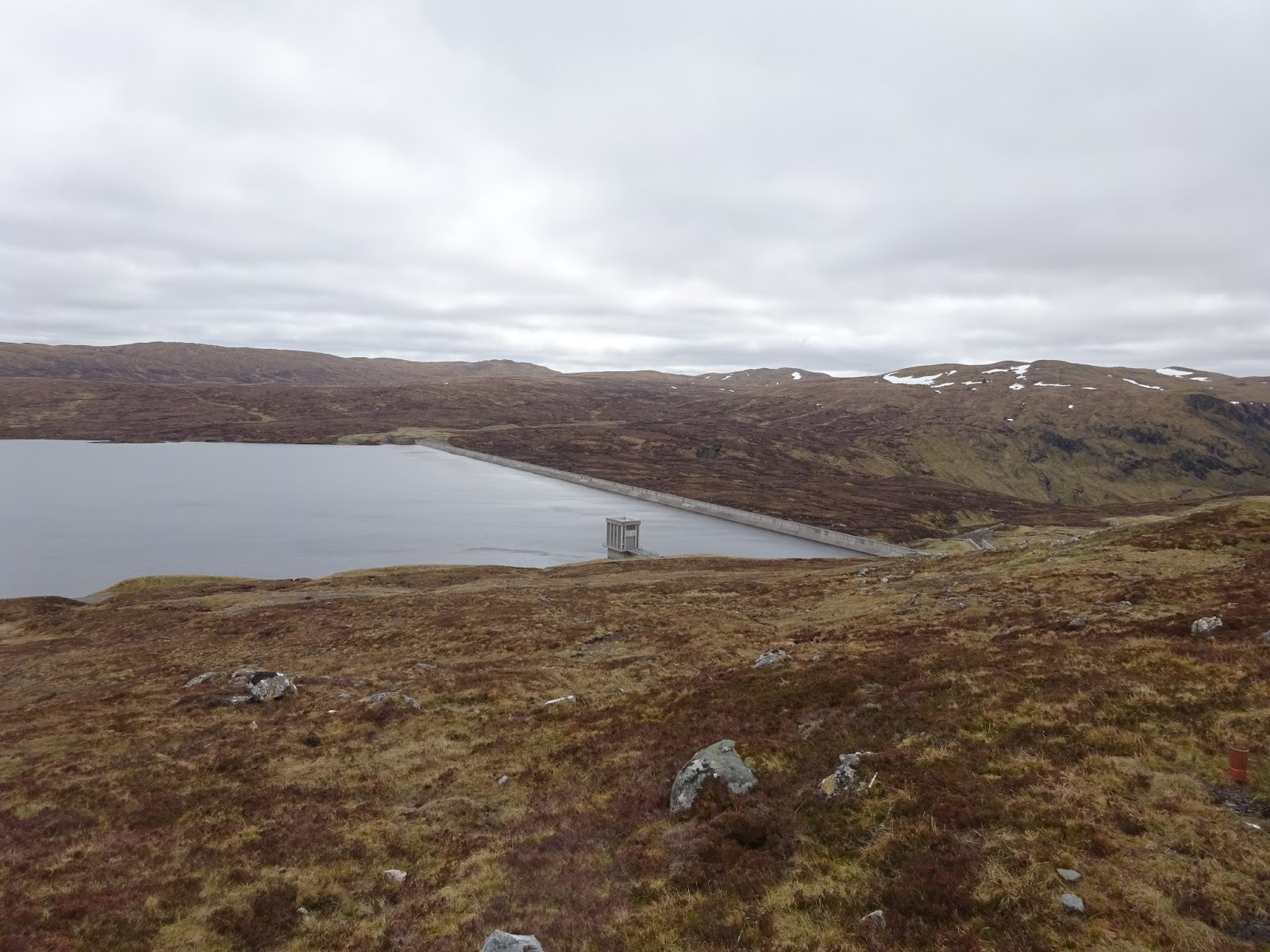
Day 5 part 1

Day 5 part 2
The morning was overcast and cool, and since we were both heading in the same direction Mervyn and I decided that if we were ready about the same time we'd hike together to begin the day.  My plan was to go further than him, but figured we could at least enjoy a little company for a while.  

Mervyn - taken later at the Ballater campsite

Lone tree up a steep hill
Mervyn leading the way up Glen Markie Burn.  We would spend most of the morning hiking up this valley.
The first part of the day was to walk up the valley that the Glen Markie Burn runs through.  It started out easy enough, with a decent trail leading up into the valley.  That soon disappeared and we followed whatever vague trails we could find along the river.  We passed quite a few ruins.  My original plan for Day 4 was to camp around one of the ruins where the map showed nice flat areas.  Turns out it would have been a nice campsite, and I wouldn't have added miles to today's hike. 

Ruins along Glen Markie

Ruins along Glen Markie


Just about out of the valley.  The Glen Markie burn narrowed quite a bit


We spent most of the morning heading up the valley.  We constantly had to cross over the river to find decent walking since the valley was narrowing and the sides were becoming steeper.  It took us about 3 hours to cover the 4.5 miles up out of the valley.  We then had to cross some boggy terrain to meet up with another trail we'd follow for the rest of the day.  I was following Mervyn and he stepped across a patch of dried mud and up onto another grass tussock.  I stepped into the mud, which turned out to not be solid and sunk in up to my thighs.  Luckily there was a big rock near me and I grabbed it and used it to pull myself out.  I didn't think to get a picture, but I was pretty much covered in mud from my thighs down. 

I walked like that for the 4 miles or so as we walked on the path above the River Eskin.  The path eventually dropped down to meet the river where we stopped for lunch.  I went down to the river and cleaned my shoes, socks, and pants off in the water.  Mervyn went on ahead once he was done with his lunch since it took me a bit longer as I had to do my laundry.  

Storm clouds started to move in pretty quickly after lunch and a light drizzle began to fall shortly after I started walking again.  Unfortunately when there's rain it means less pictures as all my electronics get put in waterproof bags and packed away .  I caught up with Mervyn about 2.5 miles further down the path at Coignafearn lodge where he stopped to put on his rain gear.  I put on my rain jacket too as it was starting to rain a bit harder and was getting colder.  The family who owned the lodge was out replacing the boards that made up the bridge over the LRT at their lodge.  

The valley we walked in for the afternoon was so wide you could fit an airfield in it.  It was an impressive open space.  When we got close enough to the bridge at Coignafeuinternich to make it out in the distance we noticed two other backpackers in the distance approaching the bridge.  They seemed to disappear as they reached the bridge.  About a quarter of a mile from the bridge the rain really began to come down and the wind picked up. The rain wouldn't stop until the next day.  Once we got to the bridge we saw the other backpackers under a stand of trees.  

View from my tent.  You can see just how wide the valley was here. 
The backpackers were Matt and Lindley from Wyoming.  We talked and all decided we would camp near the bridge if we could find a place protected from the wind.  After spending a good 20 minutes looking for a place to camp we decided to hike over to a pretty big stand of trees with some ruins around them just south of the bridge.  The trees did a good job of deflecting most of the wind so we all decided to camp there for the night.  My original plan had been to go on, but I had a pretty long crossing over trackless bog and Mervyn warned me not to try it that night as I still  had about 2.5 miles to get to the point where I would go off track.  Mervyn was also heading the same way the following day so we decided we'd stick together and do the crossing together. 

Saturday, June 18, 2016

2016 TGO Challenge Day 4

2016 TGO Challenge Day4

Planned: Fort Augustus to Glen Markie ruins (16.75 miles)
Actual: Fort Augustus to Stronelairg Lodge (15.5 miles)
Total Trip Miles: 54.25
Monday, May 16th, 2016

Day 4


After a nice breakfast in the B&B I said my goodbyes to Kenny and Ava, who I made plans to meet up with in Braemar on Friday.  This is the only day on my challenge that I walked alone all day.  My walk began with ~2mi road walk from town.  I had some pretty good views of farmland and Loch Ness for a while.  
Looking back towards Fort Augustus


The very southern tip of Loch Ness


Ruins on a farm
I turned off the paved road when I got to Glendoe Estates, which I would be walking through for most of the day.  I followed the LRT up into the hills, only seeing a pickup truck that passed me twice.  

Whatever you say, buddy.


Wind farm in the distance
A lake near the top of one of the hills


Snow up around 2,500 ft


The LRT lead me through the Glendoe Forest, up and up hills that didn't have names on the map.  For a while it seemed like the climb up would never end.  It was probably about 4 to 4.5 miles but it seemed longer.  Eventually I made it to the top, where it was probably near freezing, and then down a bit to the Glendoe Hydro Electric Dam and  reservoir.   

The monument for the Hydro Electric Dam

Close up

The dam
I walked along the reservoir for a while and had my first blackfly experience.  It wasn't bad as it was pretty windy and they seemed to dislike that.  When it would be calm they would start to swarm, but they didn't sting me so all was good.  

Finally got a pic of a grouse.  It's harder than you'd think.


After some more walking on the LRT I came to the point where I would be going off-trail across the bog to find a path.  I also had to cross a small burn (river) to get to the path.  I set a bearing on my compass and set off.  I managed to find an easy place to cross the river by hopping over some rocks, but when I got to the spot where the trail should be there was nothing.  I bog hopped in the direction I was supposed to be going, all the while looking for this nonexistent trail.  I would occasionally find vague trails, but they would soon disappear.  I was heading into a valley that the river ran down into, so I just followed the route of the river. 

Eventually I found the beginning of the trail I was supposed to be on, only the beginning was a good mile farther east than it showed on the map.  The trail took me through the valley, crossing a couple places where there had been rock slides.  


You can see the tiny new trail people have made through the rock slide

the trail I followed into the valley
I passed a guy camped on the other side of the river from me and tried to talk to him, but the rushing water was too loud and I soon gave up.  Another mile further up the trail I saw Stronelairg Lodge.  I came over the hill above the lodge so I had a good view of the roof, and as  I got closer I noticed how spooky the place looked.  The bottom floor was all boarded up, the roof was collapsing in places, and it looked like some structure off the back of the lodge had collapsed.  I was told that at some point it becomes too expensive to make it worth maintaining these lodges and the owners allow them to fall into ruin.

Stronelairg Lodge
The path crossed the front of the lodge's property and I noticed across from the front yard there was a tent pitched.  I went over to say hi and met Mervyn, who was from England, and was 67 years old(I think).  We did the usual introduction and gear talk.  He was an extremely nice guy and seemed to have lots of stories to tell.  I decided to set up camp with him as there was a relatively flat field.  This meant a longer day the next day, but there was a long-ish uphill before my planned campsite and it was relatively late in the day.