Wednesday, June 28, 2017

2017 TGO Challenge Day 4

2017 TGO Challenge Day 4

Laggan Locks (Great Glen Hostel) to Melgarve Bothy - 18 miles
Total Trip Miles: 62.5
Monday, May 15th, 2017

Day 4 part 1
Day 4 part 2
Day 4 part 3
We woke up to a constant drizzling rain outside.  Luckily we were warm and cozy in the hostel where we took our time getting ready while we waited to hear from Leslie's friend Mark.  We didn't leave the hostel until about 9:30, trying to give him time to get in touch with us.  We decided to walk to the Thistle stop cafe in Aberchalder, about 6 miles NE of us along the dismantled railway alongside Loch Oich, (also an alternate of the Great Glen way, I believe) since it was almost flat and figured that might not be so bad for Leslie's knees.
Railway Museum


Invergarry Castle


After a few miles the pain came back with a vengeance.  I could see on Leslie's face how much it was hurting her with each step, but Leslie toughed it out the entire 6 miles.  We arrived around noon and had a nice lunch at the Thistle Stop along with three other challengers who we had met on night one.  It took a while for Mark and his girlfriend Linda to show up, but they came armed with all sorts of supplies to help Leslie out.  In addition to her knees she also had a nice assortment of blisters.  

Leslie went outside to walk up and down a small hill with the knee brace to see if it made a difference.  Unfortunately it didn't and Leslie had to make the tough decision to drop out of the Challenge.  We said a relatively quick goodbye as it was already about 2:30pm and I still had quite a few miles to do over the Correyairack pass.  Mark and Linda said they would drive Leslie back to the hostel where she would be within walking distance of the train.  
Linda, Leslie, and Mark
Thanks again to Mark and Linda for helping out a friend in need!!

I realized I probably wouldn't make it to Garva bridge, which was the original stopping point for the day, having to go over the Correyairack.  I decided to aim for Melgarve bothy, and if I felt good and had time when I got there I could push on further.  
Bridge of Oich

I pushed the pace a bit, estimating I had about 12 miles to do and it was already close to 3pm.  The path was almost directly behind the Thistle Stop, but not that easy to find. The path lead steeply up the back of Druim Laragan.  Once I came around the south side of the hill, I set out NE across what would normally be bog to find the LRT that ran parallel to General Wade's Military road for a while.  I followed that path south until I could see General Wade's road and Blackburn of Correyairack bothy.  I again headed across the bog until I reached the bothy.

There were 4 people there already, and they were all staying the night.  It was about 4:30 in the afternoon at this point, so probably a safe bet.  After having a brief conversation on what a disaster Trump is for the US and the world as a whole, I headed off.

After crossing the bridge about 1 1/2 miles after the bothy, the rain and wind both started.  It would rain until after I crossed the pass.  Yet another pass that I go over in Scotland where I have no view, just like the Lairig Ghru last year.  I took a few pictures but my camera went into my backpack before I hit the top of the pass since it was raining quite hard.

Heading up the Correyairack before the rain got too bad
While not the most visually appealing thing, the power lines were a useful landmark
in near white-out conditions near the top of the pass

I was soaked, cold, and tired by the time I crossed over the top of the path, and some water had found it's way into one of my boots.  I stopped briefly to have a snack as it was about 6:30pm.

Deer on the way to Melgarve
I arrived at the bothy shortly after 8pm, went inside to say a brief hello, then pitched my tent.  Word spread pretty quick that I had a cuben fiber tent and everyone took turns coming to take a peek at it.  I sort of felt like a used car salesman going over the features of the tent time and again.  I didn't mind though, as it was a good way to talk to everyone who was at the bothy.

My tent and Melgarve bothy
I made myself dinner and got into my warm sleeping bag for the night.  I knew I had about 3 miles extra I would have to make up the next day since I had a bed booked at the Newtonmore hostel for the following night..  

Tuesday, June 27, 2017

2017 TGO Challenge Day 3

2017 TGO Challenge Day 3

Wild camp (NH 113 018) to Laggan Locks (Great Glen Hostel) - 18 miles (probably more)
Total Trip Miles: 46.5
Sunday, May 14th, 2017

Day 3 part 1
Day 3 part 2

We packed up and were out of camp a little bit before John and Neil, so we said goodbye knowing we'd probably see them a little later.  The first few miles of the day were along the paved road on the north side of the River Garry and, eventually, Loch Garry.

There's cell reception at the hubcap house
 In Tomdoun there is a church, a phone booth, and what appears to be a couple of houses.

The Tomdoun phone booth
It works!


Shortly after that we passed the old Tomdoun hotel, which is apparently now a private residence.  


It had been raining on and off all morning, but as we approached the bridge heading south across Loch Garry the wind picked up.  As we crossed the bridge we had an extremely powerful, constant wind coming from the west.  The brief time we needed to cross the bridge was enough to freeze both of us, and the rain wasn't helping.  

The sign before the bridge
Luckily the next section was through a wooded area and the freezing wind died down.  The next section was a wasteland of felled trees. 

Yours truly in the wasteland
We passed some fenced areas with sheep in them.  These guys were in a separate pen from the others and really wanted out.  


Next we had to go into a section with lots of cattle roaming around.  


We found an area where there were huge tree stumps remaining from all the trees being felled and decided to stop for lunch while we had something we could use as a table.  

The view from our lunch spot
As we were eating, a mother cow and her calf came up on the road alongside where we were eating and she stared at us while mooing.  We weren't sure what she wanted, so we continued doing what we were doing.
Moo!
 At this point, the mooing cow decided she wanted to be our friend/trample us (we're still not sure which) and started walking towards us.  We were on one side of the giant stump and the cow was on the other.  Whenever she would make a move we moved the opposite direction to keep the stump between us.  Leslie threw her food in an assumption the cow was after her re-hydrated lunch (I was skeptical).  The cow mooed some more and then walked away....disaster averted. 

Leslie with the giant stump that saved our lives, maybe
Not two minutes later John and Neil walked up the road, passing mom and calf with no reaction whatsoever.

John and Neil not being attacked by momma cow
 (note one of the giant stumps Neil is sitting on)
After chatting for a few minutes Leslie and I headed on.  With a new lease on life after our near-death experience we knew we had to keep pushing forward, we couldn't get complacent. For the next few miles, we followed the land rover tracks (LRT) until we turned off on a path heading south where we once again had some good views.


We followed the path down to the river
From the river was a 2km off trail section to get us to the edge of the hill that would take us down to Laggan lochs.  

I read in the journal of another challenger that the hill by the stand of trees was steep but do-able (where the B is on the map below).  About halfway through our off-path crossing, Leslie started getting some sharp pains in her knee. 
We were trying to end up where the B is but ended up where the A is
Somehow we got pointed in the wrong direction and ended up SW of where we wanted to go.  We came out near Kilfinnan Fall, which is a very steep ravine.  It took us a good amount of time to figure out we were too far SW and not too far NE like I thought.  While walking around trying to figure out where we were the pain in Leslie's knee was getting worse and worse quickly.  

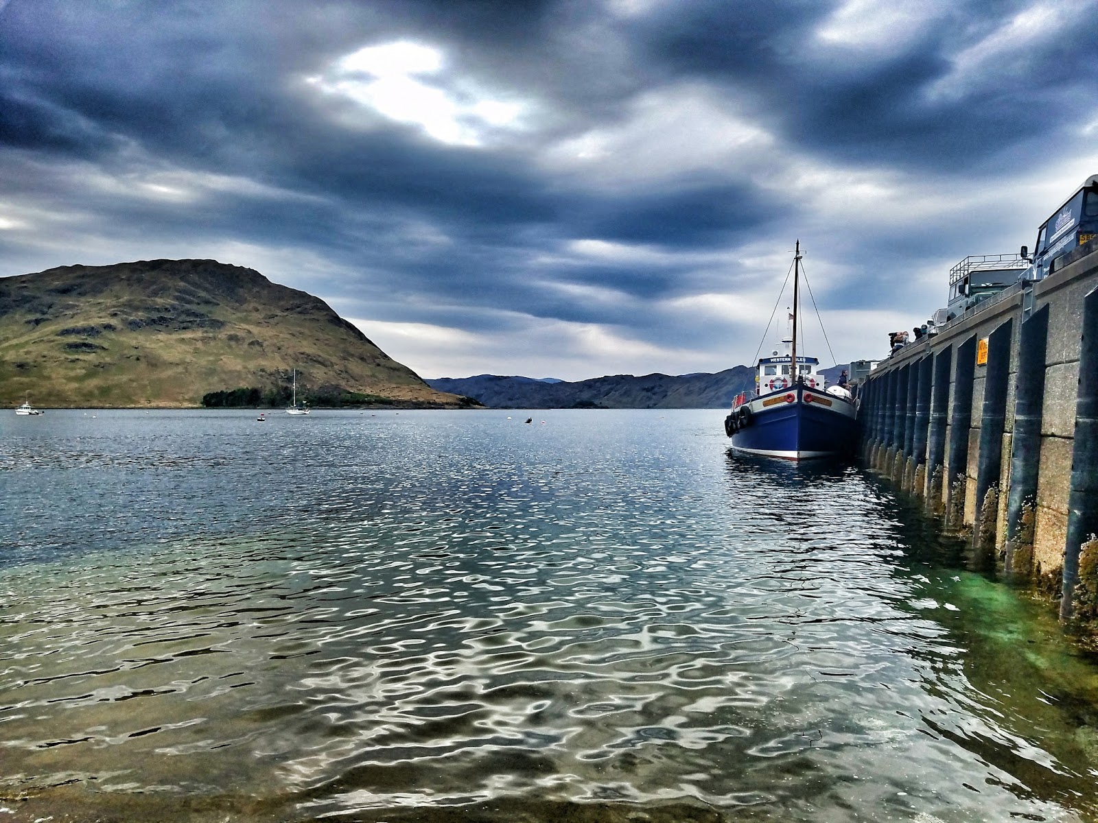
We finally figured out where we were and made our way to the proper hill to descend.  Leslie was in a lot of pain and had to go slowly down the steep hill.  We knew there was a floating bar waiting for us, and I'm fairly confident that is what kept us moving at all.  

The view down to Loch Lochy
The view down to Laggan Locks from the top of the hill

The view back up the side of the hill (it's steeper than it looks)
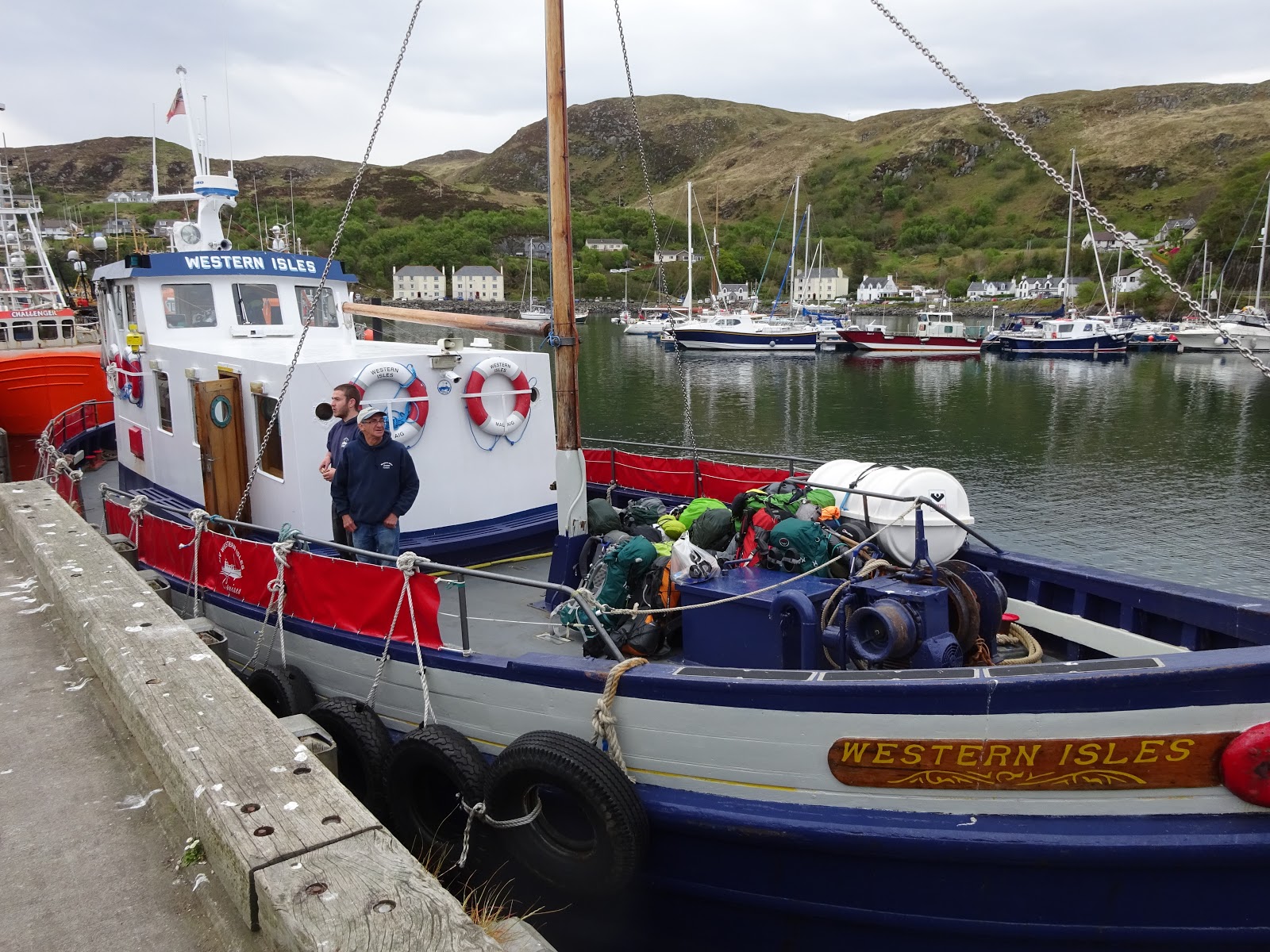
Finally we made it to the bar!  We had some beer and a nice dinner on the deck of the boat.

Exterior
Interior

The hill we walked down
After dinner we had a short but painful walk for Leslie to get to the Great Glen Hostel.  We checked in, had a shower, did some laundry, and then assessed where Leslie was at.  Just walking up the stairs in the hostel was extremely painful for her.  The front desk had a small shop and I inquired if they had a knee brace, which they did not.  Funny coincidence though, a friend of Leslie's from Florida happened to be in Scotland for a wedding and was about 1 1/2 hours north of us.  He told us he could meet us in the morning with a knee brace to see if that helped with the pain Leslie was feeling.  At least we had some semblance of a plan.

Monday, June 26, 2017

2017 TGO Challenge Day 2

2017 TGO Challenge Day 2

Runival to wild camp (NH 113 018) - 16 miles
Total Trip Miles: 28.5
Saturday, May 13th, 2017


Day 2 began following Loch Hourn east towards Kinloch Hourn.  The water was so clear you could see down to the bottom of the loch with no loss of clarity...I'm not sure why I don't have a picture of that. 
Directly in the center of this picture you can see the promontory we camped on (picture taken from Skiary)
Leslie and John along Loch Hourn

At Kinloch Hourn there is a cafe run by a very amusing man by the name of Tony that had cake, tea, and coffee for travelers.  While we were there people stopped in who were driving, backpacking but not on the challenge,  and of course a couple other challengers.  The cafe was in a very unlikely place as it just looked like a house.  It was also run on a generator, although it did have a flush toilet (luxury!).

The cafe at Kinloch Hourn
Leslie and Tony from the cafe
Just as we were leaving another challenger came along who was heading the same way as us and joined our little group.  Our original plan had been to head up along Allt Coire Sgoireadail but we knew weather was moving in and decided to take our foul weather alternative (FWA) along the road east.  The first section from Kinloch Hourn was a long uphill that seemed to go on forever.  We stopped to do some foot maintenance at the ruins of Coireshubh.


John and Neil waiting for Leslie and I to check our feet

The view northeast from Coireshubh

The road finally leveled off a bit and we had some beautiful views of Loch Cuaich and the clouds rolling in.

Glen Quoich

Leslie on the bridge

Low water levels in the loch
At the bridge over Glen Quoich, John ran into a couple Challengers he knew and stopped to chat. Leslie and I decided to keep moving as the rain had started and it was getting chilly.  At this point the rain started to really come down, so my camera went into my pack.  John and Neil caught up to us a bit further down the road, and we walked together for a while longer.  At one point we got ahead of them again and when we looked back a little further down the road they had just disappeared.  We assumed they decided to stop because the rain had really started coming down.

Leslie and I were hoping to find some shelter at the dam between the loch and Gearr Garry but the one covered area was fenced off.

We trudged eastward in the rain, which finally let up around the time we made it to Kingie.  From there it was a short walk to our campsite along Allt a Ghobhainn.  Shortly after we chose somewhere to set up John and Neil came down the road and joined us for the night.  They had disappeared because they found a spot with cell signal and had made calls home and put on rain gear.  It rained on and off most the night so we didn't have much chance to socialize once we were in camp. 

Friday, June 23, 2017

2017 TGO Challenge Day 1

2017 TGO Challenge Day 1

Mallaig to Runival - 12.5 miles
Total Trip Miles: 12.5
Friday, May 12th, 2017

(Click on any picture to make it larger)
Day 1 Part 1
Day 1 Part 2
It finally hit me when I woke up on Day 1 of the challenge that I was back in Scotland!!  Walking across the highlands one more time, and this time with a friend to share the misery enjoyment!  After a large breakfast, we checked out and headed to the harbor where we would catch the ferry to Inverie.


The Ferry

The giant pile of backpacks on the ferry


Inverie in the distance
The ferry ride was about 30 minutes and was quite chilly, Leslie got a nice video clip of the scenery:


Once we docked we walked down to the water to do the tradition toe dip.
The ferry docked at the Inverie pier (Photo by Leslie Grossman)
The Toe Dip

Yours truly in a weird pose
For those of you wondering if we're ever going to actually do the whole walking thing, this is where it begins...

After taking pictures of ourselves and others, we didn't begin walking until after 11am.  We walked down the road in Inverie, which is the most remote town (village?) of mainland UK.  It also holds the most remote bar, The Old Forge, which was closed until 3pm, I believe.  Some other challengers stopped at the cafe in town, but we figured we should get walking.  We started out with some beautiful scenery along the road.


We soon made the turn inland where we walked along the Inverie River to Loch an Dubh-Lochain


Looking back towards the coast
Challengers ahead of us going through a small forested area
Inside the forested area

The Brockett Monument

A group on horseback passed us


A small bridge over the Inverie river where it connects to Loch an Dubh-Lochain

Loch an Dubh-Lochain
 We stopped at one of the small rivers feeding into the loch to refill our water and have some lunch as it was close to 2 in the afternoon.  One challenger passed us as we ate after a brief hello.  We were sitting in the grass eating lunch, which came to an abrupt halt as I noticed a tick crawling on my pant leg.  Thanks to the permethrin I had treated my pants with it died and fell off, but we decided it was time to go!

From the loch we began the ascent up and over Mam Barrisdale which would eventually take us down into Barrisdale Bay in Loch Hourn.  About halfway up the climb we started getting some sporadic rain, and the path up was already pretty saturated (as you can see in the picture below).
Leslie before she realized the full extent of what she signed up for

The view of Gleann an Dubh-Lochain partway up Mam Barrisdale


The view of  Gleann Dubh-Lochain from about halfway up the climb

The same view even higher up

We noticed some deer across the valley on Cnuic nan Eildean (I think)

Finally at the top!

The view
At the top of the pass we ran into John J having a snack (check out his blog here).  We joined him in taking a break and then decided to hike down together as we all heading along Loch Hourn.  We had put on jackets during our break as it was cold on top of the pass, but as we descended the air got still and quite humid.  Halfway down we all had to de-layer.

We arrived at a busy Barrisdale Bothy late in the afternoon, where John had intended to stay, but he decided to push on with Leslie and me.  Leslie and I were set on making it to our chosen camp spot for the night, Runival, and at this point John said if he found something along the way he was going to stop and camp.
Barrisdale Bothy
We stopped to take pictures along Barrisdale Bay as the sun was beginning to set:


The track from Barrisdale to Runival took longer than it felt like it should have.  There were lots of little ups and downs and exhaustion was beginning to set in.  We finally made it to Runival around 8pm, but luckily summers in Scotland provide plenty of daylight (until about 10:30pm at this point) so we had plenty of time to set up camp and have dinner before turning in.
Runival -- we camped on the promontory behind the smaller tree